Posts

Archaeology 360: Hill of Slane Friary, Co. Meath

Image
Approach from the east and Slane's hill looks unassuming for somewhere with this much claimed for it - it's the spot where, in AD 433, St Patrick is said to have lit the first Paschal fire in Ireland, in deliberate defiance of the High King's ban on rival fires while the court at Tara held its own festival some ten kilometres away (the two hills, conveniently for the story, can see each other). Patrick supposedly impressed the king enough to be let carry on preaching, and put one of the king's own men, Erc, in charge here as bishop - Erc founded a monastery on the hill in the 6th century and is said to be buried in the graveyard under two gable-shaped stones known as the Bishop's Tomb. Standing between the ruins of the Franciscan College and St Patrick's Church, you're on ground that's seen most of it: a round tower here was burned by Vikings in 948, a motte and bailey went up in the 1170s (its builder, Richard Fleming, killed along with more than a hund...

Archaeology 360: Monasterboice Monastic Site, Co. Louth

Image
  You come in through the site entrance into a graveyard that's still in active use - centuries-old cross-slabs standing shoulder to shoulder with modern headstones - and the first thing that stops you is Muiredach's Cross, reckoned by most to be the finest high cross in Ireland. Walk its east face and you're looking at Old Testament scenes (Adam and Eve, David and Goliath among them); round to the west face and it switches to the New Testament, the Crucifixion and a Last Judgement, the whole thing carved - so the theory goes - by the same mason responsible for the Cross of the Scriptures at Clonmacnoise, with a pair of cats playing at the base of the shaft for good measure. It's named for Muiredach, an abbot who died in the early 920s (923 or 924, depending which source you trust), and a scaled reproduction of this exact cross stands in the Victoria and Albert Museum in London. Circle the South Church - its north side, then in through the door, then back out the west -...

Archaeology 360: Bective Abbey, Co. Meath

Image
Bective doesn't announce itself the way Tara does - you approach from the south-west across flat Boyne pastureland and the ruins seem almost modest, until you're inside them. This was Ireland's second Cistercian abbey, founded in 1147 by Murchad Ó Máel Sheachlainn, King of Meath, as a daughter house of Mellifont and, as it turned out, the only Cistercian house Meath ever got - its formal name, Abbatia de Beatitudine, translates roughly as the Abbey of Bliss. Work your way round the south-east and south-west corners and you're tracing the outer wall of what was once a much bigger complex; the site of the west range, where the lay brothers would have lived and worked, is now just a footprint in the grass, its buildings long gone. The cloister is the reason people come: rebuilt in the 15th century in Ardbraccan limestone, its arcade of gothic arches is carved with a small portrait of Bernard of Clairvaux, the Cistercian order's founding voice, tucked into one of the pi...

Archaeology 360: Hill of Tara, Co. Meath

Image
Stand on top of Tara and you're standing on the spot Irish tradition insists was the seat of the High Kings of Ireland - though don't come expecting a castle; what you're walking over is a scatter of grassy earthworks that ask a bit of imagination of you. Start where this video does, at the Banqueting Hall (Teach Miodhchuarta), not really a hall at all but a long, parallel-banked avenue at the northern end of the hill, thought to be one of the last things ever built here. Head down past the Sloping Trenches (Claonfhearta) and Rath Chaelchon, a huddle of Bronze Age burial mounds ringed with ditches on the hill's northwestern slope, then on past the Rath of the Synods - once a multi-ringed enclosure that turned up Roman trinkets when excavated, and which was badly torn up in the early 1900s by treasure hunters convinced the Ark of the Covenant was buried underneath. The big grassy ring at the centre of it all is Rath Righ, the Enclosure of the Kings, roughly a kilometre r...

Archaeology 360: Bocan Stone Circle, Co. Donegal

Image
Swing your view around this 360 shot and you're standing on Bocan Hill above Culdaff, Inishowen, in the middle of what was once a formidable ring of standing stones - somewhere around thirty of them, if the early antiquarians are to be believed, though only seven still stand today, the rest toppled or broken by time, farming, or both. Look for the pair of tall entrance stones on the northwest side, still reaching close to two metres, and you'll get a sense of how imposing this circle - some 18-20 metres across, depending on whose tape measure you trust - must have been when whole. An 1816 report tells us diggers found graves and earthen urns tucked inside the ring, which is about as close as we get to knowing why it was built at all; officially it's filed under Bronze Age with a Neolithic whisper, and unofficially it's been dubbed a "sun temple," its axis reputedly lined up east-west towards Slieve Snaght and, on a clear day, all the way to Jura in Scotland. W...

For the Attention of The Chief Archaeologist & Director of the National Museum of Ireland #TTM

Image
In 2019 The Keeper of Irish Antiquities threatened to send both the Director of the National Museum of Ireland and the Chief Archaeologist after me, but neither had sufficient backbone to either approach me or reprimand their errant employee. Now it's the back end of 2024 and there's still no end in sight. So I'm thinking it's time to resolve this. For this reason, I'm calling on  Michael MacDonagh , Chief Archaeologist at the National Monuments Service of Ireland, and Lynn Scarff , Director of the National Museum of Ireland, as well as the entire Board of the NMI ( here ) to show some forlorn modicum of actual leadership and reach out to me with a workable solution. I would point out that such a solution must include a full apology and retraction of the curel, hurtful, and simply untrue remarks made by  The Keeper of Irish Antiquities; answers to the questions repeatedly posed but unanswered by The Keeper of Irish Antiquities; as well as payment for my time in do...

Devalue the Currency! Tackling the toxicity of academic plagiarists

Image
I don’t know who first came up with the idea of canning worms – taking, say, 500g of worms and placing them securely inside a tin can. It’s clearly a terrible product, but it has given us a really useful phrase. The idea that you can start off trying to solve a problem only to discover that it’s a whole lot worse than you ever imagined. Well … I had what I thought was a simple problem. Andrew Bevan, a lecturer at University College London’s Institute of Archaeology, had published a paper that relied in part on work that I had done, but had chosen not to give that work appropriate credit in the resulting paper. I initially thought that talking to him about it would make him see that he had done wrong and that he could be persuaded to make amends. That proved fruitless, with Bevan insisting that my work didn’t deserve to be listed in the bibliography. I took my complaint to his university who, after prevaricating, ignoring, and general gaslighting, found that his actions didn’t meet the ...

Archaeology 360: Kilmacduagh Monastery. Part III: The Round Tower and Cathedral

Image
If you've travelled with me on this 3D, 360-degree tour of Kilmacduagh, Co. Galway, you’ll have seen the O'Heyne's Church [ here ] and The Glebe House & Temple Mary [ here ] (and if not, why not? … go back & check them out … I’ll wait!). Well, now it’s time to move on to the concluding part and visit the Round Tower and Cathedral – the twin jewels of this delightful monastic site. The most striking element of the site is obviously the Round Tower. It dates to the 12th century and, standing 34m tall, it is the tallest surviving round tower. Famously, the tower deviates from the vertical and is often compared to the Leaning Tower of Pisa, mostly by people who’ve never been to Italy or seen a picture of just how much either tower actually leans. The Cathedral building has a long and relatively complex history of construction, expansion, and renovation. It appears that the west wall of the Nave is the oldest surviving portion of the building and a blocked doorway (11th-...

Archaeology 360: Kilmacduagh Monastery. Part II: The Glebe House & Temple Mary

Image
Following my visiting O'Heyne's Church [ here ] I moved on to some of the other sites of Kilmacduagh. First stop was to the Glebe House and then to the ruin of Temple Mary. The Glebe House is believed to have been the Bishop's residence and was restored some years ago. With the key, borrowed from a nearby resident, the visitor can venture inside and explore building. Although the rooms are bare, it is worth making the effort to see the remarkable oak carpentry work that went into recreating the floors and the roof. Across the road and over the wall is the simple, but quite beautiful church known as Temple Mary. It dates to the 13th century, but incorporates stones from an earlier church on the site [ Irish Stones ] I’ve compiled the tour into a consecutive YouTube playlist [ here ] , or you can access each video clip individually: Part I: Outside the Glebe House, to the NE  [0:45] Part II:  Glebe House, Ground Floor   [0:43] Part III: Glebe House, Top Floor  [0:...

Archaeology 360: Kilmacduagh Monastery. Part I: O'Heyne's Church

Image
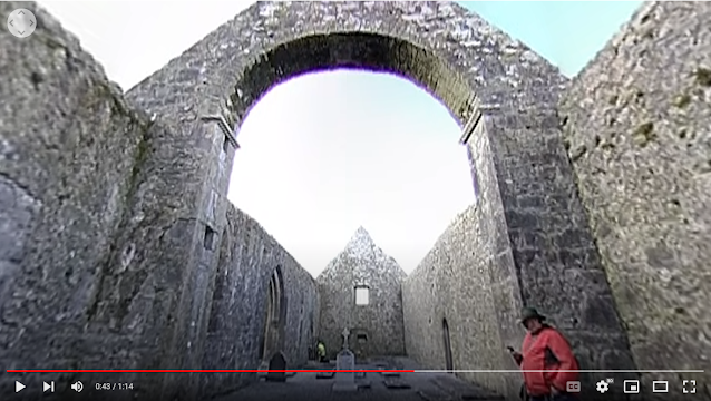
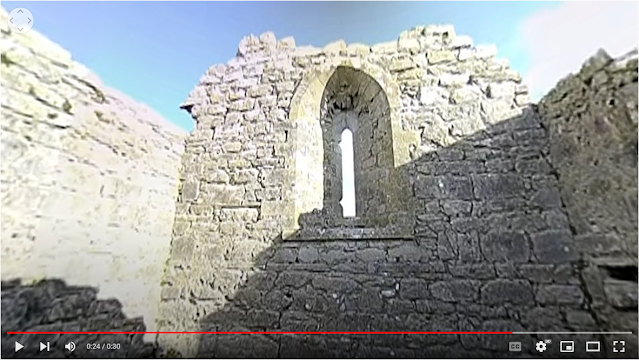
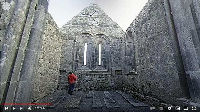
The monastery of Kilmacduagh, Co. Galway, is believed to have been founded in the 7th century by St Colman. None of the surviving buildings date to that early period, but many fine examples of medieval architecture survive here. I've broken this tour down into several segments, the first one being a visit to the 13th century remains of the O'Heyne's Church [ Irish Stones ]. I’ve compiled the tour into a consecutive YouTube playlist [ here ] , or you can access each video clip individually here: Part I: Outside, to the NE [0:23] Part II:  Outside the East Window   [1:35] Part III: External, to the S [1:03] Part IV: Internal, by the Chancel Arch [0:24] You can view this 360-degree video on an ordinary browser or on the dedicated YouTube app for your smartphone. However, for best results we recommend the more immersive experience that comes with an Oculus/Google Cardboard headset. Please feel free to  Like  and  Share  the video and  Subscribe ...

Archaeology 360: St. Patrick's High Cross, Carndonagh, Co Donegal

Image
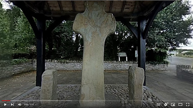
First there were cross slabs (slabs of stone with crosses carved on them, like at Fahan Mura ) and eventually there were the great High Crosses (like at Kells, Co. Meath). But … somewhere between the two lies St Patrick’s Cross at Carndonagh, Co. Donegal. Although art historians still argue over the dating of the sequence, it is generally thought that the cross at Carndonagh dates to the middle of the 7 th century. The eastern face is decorated with ribbon interlace. The upper portion of the western face is filled with a Greek cross, in similar ribbon interlace while the lower stem bears a depiction of Christ in low relief. Flanking the cross are two pillar stones decorated with human figures. The pillar to the south of the cross had a carving of a figure with a bell that might be a bishop or pilgrim. Another face of the same stone bears an unusual figure, apparently bearing a fine set of horns. The northern pillar has depictions of a warrior (with shield) and King David (with harp). ...

Archaeology 360: Temple of Deen Court Tomb, Co Donegal

Image
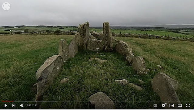
Court tombs are typically composed of a stone-built burial chamber, paired with an open courtyard (hence the name). Built during the 4 th millennium BC, around 390 examples survive in Ireland [ Wiki ]. The example at Larahirrel, outside the village of Bocan, is pretty well preserved with an identifiable court and chamber stones surviving in situ , even if most of the cairn material is long gone. The surviving upright stones are spectacular and the windswept hilltop it sits on gives impressive views across the countryside in all directions. I didn’t visit during the nicest weather, but you can still get a sense of the great views across the landscape as well as the beauty of the site itself. I’ve compiled the tour into a consecutive YouTube playlist [ here ], or you can access each video clip individually here: Part I: Outside, to the SW [1:16] Part II: Outside, to the NW, by the court [1:23] Part III: Inside the court [1:23] Part IV: Outside, to the N [1:03] Part V: In...

Archaeology 360: Fahan Mura, Co Donegal

Image
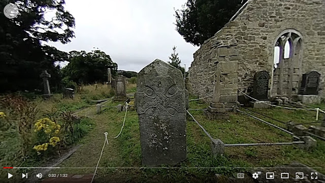
At first glimpse, there’s little remarkable about Fahan Mura graveyard. Sure, there was a monastery here from the 6 th century, but nothing identifiable survives above ground and the standing ruins date to the 16 th and 17 th centuries. Throw a stone in rural Ireland and it has a decent chance of landing in a similar churchyard. What sets this site apart, however, is the absolutely magnificent 7 th century cross-slab of St Mura (though some argue that it slightly later in the sequence of ancient cross carving). There is an interlaced long-stemmed, Latin, cross on both sides, though on the west face there are (difficult to see) representation of two human figures. It’s debatable who they might represent, but the local tradition that one of them is old Mura himself has much to recommend it. Quite apart from its artistic merit, the Fahan cross-slab is of importance as it is one of only two ancient examples of continuous Greek script surviving from early Ireland. In this instance the s...

Crannogs and binoculars hang from the head of the mule … | Part IV | May 23 2012-November 28 2016 & Conclusions

Image
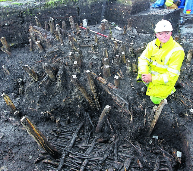
< Back to Index May 23 (pp 250-6) Document 44 is seven-page typed letter on Roads Service headed paper, from McKinley & Keenan to Cooney. They state that ‘To avoid duplication and to assist you, we do not propose to submit a formal statement as such, but instead would make the following comments against the points listed in your letter.’   Under the heading ‘Relationships and balance therein between DRD Roads Service and DOE NIEA’ they note that they ‘enjoyed an open, transparent and respectful relationship throughout the project.’ They acknowledge that they were informed by NIEA of a possible crannog in the lake during ‘the preliminary and statutory consultation stage’, but that, owing to the ground conditions, it could not be precisely identified by Hurl. They went ahead with developing their preferred route and it was only when they received the borehole evidence, indicating archaeological material remaining in situ , that they were convinced of the presence of a po...